ROUTE 1:
From San Andrés
to Maspalomas Lighthouse
Day 1: From San Andrés to Cruz de Tejeda

San Andrés
Fully energized and packed with only the bare necessities we started our big 2-day hike at San Andrés.
San Andres is located in the Arucas municipality, north of the Island of Gran Canaria, in the Province of Las Palmas.
San Andrés is visited mostly by the population from the north of the Island, and despite having great winds and strong waves, it is ideal to take a quiet and relaxed day, away from the great sounds of the city.
The beach has a mixture of black and yellow sand, and it also has rocks. The amount of sand you can see depends a lot on the wind currents and the time of year you decide to visit.
Thanks to the fact that a few waves are formed, it is perfect for surfing. But be careful with some rocks that are nestled in the middle of the water, if the tide is high, you will not see them.
The town has a beach with a length of almost half a kilometer, which has a large promenade, where you can take long walks, and enjoy beautiful landscapes, stand on a rock and take the best photos of all. It has danger signaling flags, but it does not have lifeguards, you must be aware of yourself and yours so that this visit to the beach is one of the best.
If you are a born surfer, or you want to start in the sport of surfing, this beach is the right one for you, it has a small kiosk with all the necessary equipment, so go ahead and visit this coast of Gran Canaria Island.

Barranco Azuaje
Walking straight in the direction of Maspalomas, our end goal, we soon found ourselves in Barranco Azuaje.
The Azuaje ravine is located in the north of Gran Canaria and is the geographical border of the municipalities of Firgas (70%) and Moya (30%). Azuaje has a good flow of water throughout the year. That is why it has incredible biological wealth. This makes it one of the greenest and, therefore, most beautiful ravines in Gran Canaria.
The name of Azuaje comes from the last name of Francisco Azuaje, a former alderman, a sugar industrialist in the Guadalupe ravine.
Azuaje is born at the summit and flows into the sea. Throughout its journey, its name changes. Its source is at approximately 1,620 m of altitude in the Degollada de Las Palomas (Valleseco) where it is known as the Crespo ravine. Later it joins other ravines and is renamed Barranco de la Virgen, later Barranco de Guadalupe (at the height of Firgas village). It then takes the name of Azuaje until it reaches its mouth on the coast of San Andrés.
The Azuaje ravine still preserves part of the laurel forest of Gran Canaria, it has areas of reed beds, willows, and some Canarian endemic species such as the bicácaro.

Balneario de Azuaje
Hiking in this wilderness we saw a giant old abandoned building filled with graffiti art. This is Balneario de Azuaje.
The fact that Gran Canaria is an island of volcanic origin has favored the birth of water springs with mineral-medicinal properties like this one. The waters that flow through Azuaje are rich in iron, silicates, carbon dioxide, and sodium bicarbonate, besides, many ferruginous. Hence, Firgas waters are cardioprotective and contain digestive and diuretic properties, ideal for kidney problems.
Around 1868 and, after the healing fame that the Azuaje baths (Fuente Santa) achieved, Dr. Casares affirmed that the Azuaje hot springs activated circulation, sedated the nervous system, promoted perspiration and urine secretion, among other benefits. For this reason, at the end of the 19th century, the first tourists came to Gran Canaria to try these healing properties and in 1868 a small hotel with 16 rooms was built. Finally, the spa closed its doors around 1938 for health reasons and circumstances linked to the war conflicts.
The hike at Azuaje
along the path some steps must be done on tree trunks that cross the stream, climb some areas holding on to stones, and ascend two sections using ropes.
It is very important that if you want to do this route, you preferably wear trekking boots.

Valsendero
As we progressed in the hike we got spoken to by locals in Valsendero to drink a beer with them.
Valsendero is a hamlet that is located in the Barranco de la Virgen, in ancient times the place was known by the name of ‘bad path’ since the area has a lot of ups and downs.
Going through the Barranco de la Virgen in one day is almost impossible because you find small corners of great beauty everywhere, especially in the autumn season when the chestnuts begin to fall, although the time of year in which you visit Valsendero does not matter much. Whenever one goes, one cannot stop being surprised by the great variety of flora that we find at every step we take. In summer it is also advisable to walk through this ravine since the shade provided by the great vegetation concentrated there. It makes it a joy to stroll quietly and for those who like cooler air in autumn with the fall of chestnuts, the concentrated humidity makes it perfect for photography lovers, hours fly by photographing every little detail that this great ravine hides.
Barranco de la virgen
Even though it’s one of Gran Canaria’s largest ravines, it remains unknown to many hikers.
The laurel forest that once covered this area was destroyed to provide fuel for the sugar mills and obtain more land for crops. In the 16th century, measures were taken to preserve the wealth of flora, but pressure from tenant farmers and landowners led to the destruction of the Doramas forest. The area is now known as Doramas Rural Park, named in memory of Doramas, an early indigenous chief.

Barranco de la Virgen is in the west of Valleseco and is home to relict fragments of the laurel forest of Gran Canaria, known as Selva de Doramas (Doramas Forest) and praised in the work of literary figure Bartolomé Cairasco de Figueroa.
The following excerpt from the journal of English writer and traveler Olivia Stone, who visited the islands in 1885, attests to the exuberant past of the ravine.
Mrs. Stone had been in Gran Canaria for two months when her expedition set off for the town of Firgas.
“Breakfast over, we are again in the saddle, on our way to the Barranco of the Virgin. The path is rough, even dangerous in places, but the glimpses of the loveliness of the Barranco revealed by each turn of the road fully compensate for the fatigue of the traveling. Speaking broadly, the Barranco consists of a long valley, more or less straight, leading up from the sea, and then of two branches, or fork-valleys, which wind about in a serpentine fashion. Everywhere the valley is wide and deep. The higher slopes are gradual and cultivated; the lower depths are precipitous and wild. The actual bottom, just now occupied by a deep, rushing torrent, is at places enclosed on both sides by sheer rock, over which are clustering masses of green foliage and festoons of beautiful trailing plants…. Descending by a tortuous path, our horses at first refuse to enter the swiftly rushing, muddy torrent, for they are unaccustomed to such a sight, and when at last we overcome their reluctance, the water rises as high as their shoulders, so that we have to hold our legs up to prevent getting wet. From the other side on looking up, we see a long, attenuated waterfall, surrounded by the most vividly green vegetation that can be imagined. ….the bottom of the gorge is broad, gently inclining on either side of the stream for a considerable distance, which meanders, with countless windings, over its rocky bed, amongst the gigantic stems of the trees fringing its banks. Delicate ferns and bright green grass form a soft and rest-suggesting carpet”
We stopped for a quick shower in the waterfall Mrs. Stone talks about, it’s called the Andén waterfall.
Autumn in Gran Canaria passes mostly unnoticed, but by visiting spots as remote as Barranco de Crespo and Barranco de La Virgen, and in general the higher part of Valleseco, we can discover the range of colors of the deciduous trees that grow there. Their symphony of colors marks the arrival of autumn. Chestnuts, walnut trees, poplars, oaks, and banana plants decorate the autumn landscape and even though they’re not natives, they put on a great show for hikers in autumn.

Cruz de Tejeda
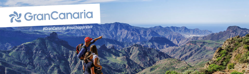
After this refreshing stop, we kept walking towards our goal for the first day and reached Cruz de Tejeda. It is a somber carved stone cross on a mountain pass at 1580 m (5184 ft) above sea level, marking the geographical center of Gran Canaria. At this popular sightseeing attraction, you’ll find bustling restaurants and bars, shops selling souvenirs and other local specialties, including great honey, and a man offering donkey rides to children. This is a good place to sit back, relax and enjoy a cup of coffee. If you crave peace, then you should avoid this area at weekends, as this is also a favorite place of excursion for the locals.
The high peaks will attract serious walkers and climbers but this area also offers relatively short and easy walks to tempt the less energetic for a pleasant stroll amid this dazzling scenery. Whilst some of these walks are new, most of them are Caminos Reales (royal paths), ancient tracks traversed by the Guanches – the first known inhabitants of the Canary Islands – to get around the center of the island.
This was the last civilized place before reaching our resting spot at La Cumbre.

La Cumbre
We arrived at Lucas’ house at sunset which has the most beautiful view of Gran Canaria you can imagine. La cumbre translates as ‘the peak’.
This vast protected landscape occupies part of the municipalities of Artenara, Gáldar, Santa Mª de Guía, Moya, Valleseco, Tejeda, San Mateo, and Valsequillo and has an area of 4329 hectares. As its name suggests, it is a landscape located in a sector of the island’s summits, specifically where the headwaters of the main ravines in the north and northeast of Gran Canaria are located.
It is characterized because, due to its layout, it plays a notable role in the maintenance of essential ecological processes such as water collection, since it is located on the north facade and in the sector of the island’s summit. In addition, most of the headwaters of the main ravines in the northeast of the island are inserted in it. In most of the lower reaches of these ravines, there are dams. There are abundant endemic species and endangered species such as the silver daisy.
It is important to note that the volcanism in the area belongs to the second insular eruptive cycle, along with other more recent ones such as those belonging to El Montañón Negro or the Caldera de Los Pinos de Gáldar.
After making some good fuel food we went to bed to re-energize for the next day.
DISCOVER THE EXPERIENCES LIVED ON THE DAY 1
Day 2: From Cruz de Tejeda to Maspalomas

Camino de Santiago
We woke up feeling great and ready for day 2. The hike this day was longer and much warmer, the more we went to the south. This meant we had to rehydrate a lot during this hike. Time passed by quickly in the beginning until we arrived at the Camino Canario.
What is the Camino Canario?
The Camino de Santiago is made up of a good variety of routes, which are divided into main and secondary ones. But we also find routes that manage to connect points that, for many, might seem impossible to do. One of these possibilities is found in the Canary Islands Way, a route that allows us to do the Camino de Santiago from Gran Canaria.
To get to know the stage in-depth, we will first define a little of its history. The existence of this route, according to popular tradition, dates back to the 16th century, when some Galician sailors, grateful for having been saved from a storm, made a promise in their prayers to Santiago. As they contemplated the covers of Tirajana and ascended with the image of the saint, they did not hesitate to promise to build a chapel for veneration.
From this moment on and even today, it has become one of the points that celebrate the Jacobean Year. It was in 1992 when John Paul II granted it perpetuity, being able to celebrate and win at this point the Jubilee in the Jacobean Holy Years.

Why choose the Camino Canario to do the Camino de Santiago?
As it is one of the points that have similar privileges to those presented in Santiago de Compostela, it is a really interesting point for the pilgrims. All those who want to do the Canary Islands Way can accredit their pilgrimage, having to get the credential of the island, which can be obtained at the Association of Friends of the Camino de Santiago de las Palmas.
This is where we set off for one of the most interesting and important points when preparing our Camino Canario. This is because we have not only one route, but three different options that will lead us to have to stamp the credential at different points depending on the route chosen.
Routes of the Camino Canario (Camino de Santiago)
The Camino Canario is made up of three interesting options, although there are two sections of the route that have suffered from fires in recent years. However, there is nothing to stop the routes from being filled with astonishing beauty. Of course, what we must bear in mind is that the official Jacobean route covers a large part of the island from south to north, starting in Tunte and ending in Gáldar.
The next option is a little more extensive than the previous one and is since, traditionally, pilgrims choose to start a little further from Tunte, exactly in the Dunes of Maspalomas, thus giving rise to a route that is usually done in 3 or 4 days approximately. In this way, we find ourselves with a route that has an approximate extension of 70 kilometers and that will take us from the dunes of Maspalomas to Gáldar.
Finally, the most outstanding option for the most intrepid pilgrims is presented. The reason for this? While there are pilgrims who do not just leave their steps in Santiago de Compostela but guide them to Fisterra, in Gran Canaria you can do something similar. This route is presented under the name of “Costa a Costa” and is that all those pilgrims who arrive and visit the Church of Gáldar, can continue their journey to El Agujero, a descent of approximately 2 kilometers that will guide us to the nearest and best-known beach of the place.
Pilancones
We hiked through a small part of the Pilancones.
Pilancones Natural Park is located in San Bartolomé de Tirajana municipality on the island of Gran Canaria, Spain. Its area is 5794.4 ha. It adjoins Roque Nublo country park to the north, and Fataga protected area to the east. The park plays an important role in soil protection and the replenishment of an aquifer, along which several ravines are running southward which are of geomorphological interest and landscape value. The pine forests on hilltops are a well-preserved habitat with abundant birdlife. The park also harbors several varieties of cactus and spurge and many aquatic habitats. The park takes its name from natural pools, formerly known locally as Pilancones, which remain after the runoff of water. Throughout the area, there are threatened animal and plant species, and features of scientific interest.
Space was named Parque Natural (Natural Park) de Ayagaures y Pilancones in 1987 and classified in 1994 as Parque natural. Within the park are open-country areas (montes) accessible to the public: “Ayagaures y Pilancones”, and the public amenity areas of “La Plata, San Bartolomé y Maspalomas” and “Montaña del Rey”. It has also been declared an ecologically sensitive area and a zone of special protection for birds under an EU directive.
Within the park stood the so-called Pino de Pilancones (Pilancones pine tree), of the Pinus Canariensis variety, which was destroyed in a storm that struck Gran Canaria in 2008. Over 500 years old and 30-40m in height, it had been ranked among the hundred most notable trees in Spain. Its death was inevitable after the fires that ravaged part of the center of the island in the summer of 2007. The dendrochronologist M. Génova (with C. Santana and B. Martínez), studying growth patterns of a specimen of this tree sent to Universidad Politécnica de Madrid in 2009, found an average age of 542 years, the oldest known age for any Canarian pine. To this period was added an estimated 8 years to reach the height from which the specimen was taken. In this way, the Pino de Pilancones has been dated to around the winter of 1457-1458, at the end of the medieval period.

Fataga
Following this trail, we arrived in Fataga where we met Manuel Moreno, an old inhabitant of the village, who told us more about the history of this place.
The small pueblo (village) of Fataga nestles in the so-called Valley of the Thousand Palms, in a picturesque setting of tall cliffs, palms, and fruit trees – 30 minutes north of the beach resort, Playa del Inglés.
Perched on a rock threatening to precipitate into the gorge, this enchanted mountain village with charming rural houses, palm groves, and a quaint church is considered the most beautiful village on the island. Once there, you might as well visit the pretty craft shops with all sorts of handmade products to take home as souvenirs, such as shawls, pottery, or wickerwork.
There are also several pleasant restaurants and bars inviting you to sit and enjoy the pleasures of life in beautiful and tranquil surroundings.
Near the village, you will find the two “presas” (reservoirs) de Chira and Las Niñas, both set in superb surroundings, which definitely deserve a visit because of the magnificent views and tranquility these places have to offer.

Arteara
The next stop was Arteara where we saw the Necropolis.
The Arteara Necropolis is the largest aboriginal cemetery of its kind on the island, both in terms of size and number of burial mounds there. It occupies an area of 137,570 m2 and houses 809 tomb structures, with both individual and collective burial mounds.
It is located on a malpaís, an arid, rocky area caused by the pile-up of phonolite volcanic rock following an avalanche. Arteara has also been a center for astronomical studies, revealing just what an extensive knowledge the Ancient Canarians must have had about the stars, to such an extent that they built the “King’s Tomb” in such a strategic place that the sunlit it upright on the day of the equinox.
It is located next to the tiny village of Arteara, on a site that contrasts a green palm grove with a rugged rocky terrain, making for a truly beautiful spot. From the necropolis, visitors can also make out the amazing cliffs of Amurga whose steep walls rise to over 1,000m altitudes, at the spot where on days of the equinox the early morning sun will light up the “King’s Tomb”.
A Visitors Centre and a tour around the Necropolis will reveal all about the life and death of the Ancient Canarians.
From this point, the end is in sight and we did our last big stretch of about 10-15km in the same direction to Maspalomas.

Maspalomas
Dunes by the Lighthouse
The Maspalomas Lighthouse is in the south of Gran Canaria, right in the middle of one of the most visited sections of the coastline in Europe. Maspalomas, Playa del Inglés, and Meloneras offer a vast number of hotels and apartments, loads of leisure options during the day, and attractive nightlife around the beaches. People out walking, surfers, and nudists mingle freely on a beach which also has quiet, isolated areas for nude bathing.
However, Maspalomas is not just known for its enormous expanse of dunes next to the sea or its great climate. It is also known for its old Lighthouse, which saw the first tourists arrive, and witnessed the area turn into a holiday resort. Ever since it dawned on the first travelers that the warm temperatures were no fluke on this endless beach, the Maspalomas Lighthouse has been the silent witness to thousands of days of sun, honeymoons, dips in the sea, and strolls along the promenade.
The decision to build the lighthouse was made in 1861, although it actually took 28 long years to finish. At the time, the place was an uninhabited, desert paradise, cut off from the rest of the island. To build the lighthouse, which stands 55 meters high, they used a dock with a small ramp to unload the materials, which could only be brought in by sea.
The lighthouse light shone for the first time on 1st February 1890. It was the only construction at the end of a long strip of sand which started at what is now the Playa del Inglés and tailed off close to the Maspalomas Oasis. It helped to guide steamboats that covered routes between Europe, Africa, and America.
Nowadays everything around it has changed. Now it is at the start of a busy promenade area with a whole host of restaurants and gift shops. It is the perfect place to shop, stop off after a day at the beach, go out for dinner or simply have a drink next to the long seashore.
Just a few meters from the promenade, bathers and walkers dive into the sand which marks the start of the Maspalomas Natural Dune Reserve, made up of three ecosystems: Palmeral, Charca, and Dunas (Palms, Pond, and Dunes) which run in parallel a few meters from the sea. The whole area is an enormous, exceptionally valuable natural space.
The beach has solitary and isolated sections, where nudism is popular. From the Maspalomas Lighthouse to Playa del Inglés, the nudist area is found between beach bars 3 and 4. From Playa del Inglés to the Maspalomas Lighthouse, the nudist area is found between beach bars 5 and 6. Surfers congregate on the bend joining Maspalomas with Playa del Inglés.
Just a little further on from the Maspalomas Palm Tree plantation (Palmeral) you will find another protected natural space, Charca, which lies between the sea and the sand, providing a resting spot for birds migrating from Europe to Africa. The huge expanse of sand dunes starts beyond this ‘pond’, changing their shape continually, chiseled out by the wind coming off the ocean.
From the Lighthouse, and heading towards the dunes along the seashore, we reach the Punta de Maspalomas, which connects with the Playa del Inglés. It is the same beach, which just changes its name at this point. Visitors here soon latch on to our healthy custom of walking from one end to the other.
Many things have changed since 1861, but Maspalomas continues to be the perfect place to unwind, enjoy the sea, or simply while away the hours of sunbathing. This hasn’t changed, and neither has the long shadow of the Lighthouse, in the same place as ever. Whereas before it looked out for boats crossing the Atlantic, it now envies beach-goers spending their days under the gentle sun in Maspalomas.
DISCOVER THE EXPERIENCES LIVED ON THE DAY 2
ABOUT THE PROJECT
Plan a Hike
If you are planning to come to Gran Canaria during your holidays
we can provide all that you need to have a blast on your vacation

GRAN CANARIA
PET-FRIENDLY DESTINATION
For animal lovers like us, Gran Canaria is an ideal place to travel and explore with your pet, if not, let them tell our dog Gofio how he enjoys his excursions exploring the island.
A Pet-Friendly destination par excellence, Gran Canaria is an island that loves and accepts pets. If you come on vacation to Gran Canaria you will find a variety of hotels, apartments, and rural houses that love to have animals as guests. And to eat out, don’t worry, because fortunately some restaurants and bars are pet-friendly and warmly welcome your faithful friend.
Enjoy long walks through nature and the beaches of Gran Canaria with your pets.
Check all the Pet-Friendly Gran Canaria services here:
SPONSORS AND PARTNERS